Horse drawn vehicle licence
[item_table]
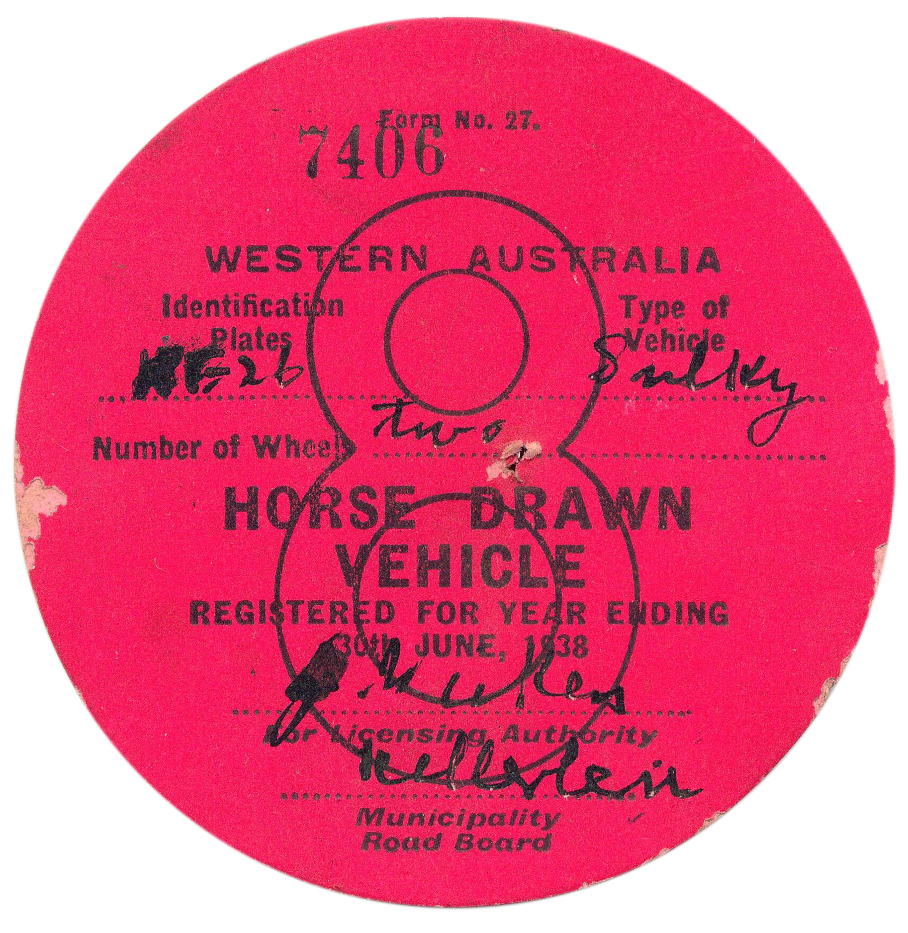
This licence ‘sticker’ is for a horse-drawn vehicle (two wheel sulky), for the Municipality Road Board of Kellerberrin for the year ending 39 June 1938. The Landgate website shows the following for Kellerberrin.
Latitude 31° 38′ S Longitude 117° 42′ E
Kellerberrin is a townsite in the central agricultural area, 203 km from Perth on the Great Eastern Highway. The railway line from Northam to Southern Cross was constructed through here in 1893-4, and this section opened for traffic in 1895. Kellerberrin was one of the original stations when the line opened. By 1898 there was a demand for small blocks of land in the area, and the government surveyed a number of 20 acre lots the same year. The area was gazetted as Kellerberrin townsite in 1901, and the government soon made more land available for settlers.
The name Kellerberrin is Aboriginal, and is derived from the name of a nearby hill. The hill was first recorded as “Killaburing Hill” by an explorer in 1861, but in 1864 the explorer C C Hunt recorded it as Kellerberrin Hill. One source claims that Kellerberrin is the name for the fierce ants that are found in the area, while another gives it as meaning “camping place near where rainbow birds are found”- “kalla means camping place or place of, and “berrin berrin” is the rainbow bird.